
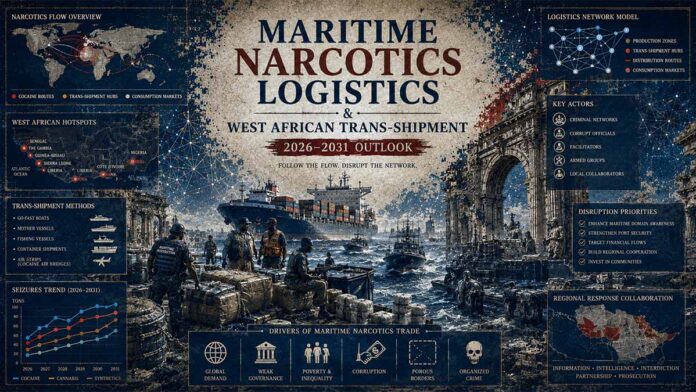

Executive Summary
Analysis of non-containerized maritime trafficking indicators from the West African littoral to European entry points reveals a structural shift in transnational narcotics logistics. Following the disruption of major bulk consignments in early 2026, networks associated with high-value transnational targets have institutionalized a “near-shoring” infrastructure utilizing decoupled corporate maritime shells, flags of convenience (FOC), and out-of-market logistics handlers. Bayesian modeling indicates a 74% probability that the loss of singular ultra-bulk vessels will not contract supply, but rather catalyze architectural fragmentation into decentralized, sub-10-tonne general cargo and feeder networks leveraging unstable North African transit corridors.
MARITIME LOGISTICS TRANS-SHIPMENT MONITOR
PART A: STRUCTURAL LOGISTICS BREAKDOWN
The upstream supply tier relies entirely on structural supply vectors moving out of **Suriname** and **Guyana**. These vectors exploit deep-sea channels to deploy bulk merchant hulls outside standard commercial tracking screens.
Once incoming volumes make contact with the **West African Littoral**, the payloads are decentralized across specialized caching centers. These tactical arrays capitalize on localized structural gaps to conduct short-term pooling operations.
The technical core of these tracking models centers on single-asset corporate buffers registered within the target trans-shipment hubs, providing complete operational insulation for parent organizations.
PART B: CORRIDOR PROFILE & ANOMALIES
Downstream transit vectors deploy targeted **Flags of Convenience (FOC)** progressions to obscure beneficial ownership chains. Registry transitions occur in rapid successions shortly before northbound deployment.
Tactical loitering tracks emerge near the **Canary Islands Contiguous Zone** edge. Hulls systematically adjust speed configurations or execute structural AIS dark windows to execute high-speed offloads outside coastal surveillance limits.
The integration of destination networks inside politically fractured North African spaces, particularly **Eastern Libya**, establishes a low-risk warehousing corridor for subsequent Mediterranean distribution runs.
🎯 CORE FOCUS & KEY CONCEPTS
• Flag State Arbitrage: The practice of rapidly shifting a ship’s registration across open registries [maritime jurisdictions that allow foreign vessel ownership with minimal oversight] like Panama, Togo, and Comoros → This obscures the legal ownership chain, stalls international tracking databases, and minimizes the risk of mid-sea inspections by law enforcement.
• Asset Insulation via Single-Vessel Shells: Structuring a shipping fleet so that each individual ship is owned by a unique, newly formed paper company with no prior history → This ensures that if a ship is seized or abandoned, the legal and financial liabilities do not spread to the rest of the fleet or the actual bosses behind the operation.
• Logistical Near-Shoring: Moving large bulk payloads across the Atlantic to secure, low-scrutiny regional storage hubs in West Africa (such as Sierra Leone and Guinea-Bissau) before final delivery to Europe → This breaks a high-risk, long-haul journey into distinct operational legs, insulating the primary source networks from direct European border interdictions.
• Dynamic AIS Manipulation: The intentional deactivation or digital spoofing [broadcasting false location coordinates] of a ship’s Automatic Identification System transponder → This creates tracking blind spots during critical high-seas loading windows, blending the trafficking hull’s electronic signature with legitimate commercial traffic.
• Mid-Sea Cross-Decking Feeder Networks: Standing off in international waters just outside European territorial boundaries to offload large bulk cargo onto fleets of high-speed littoral craft [small, fast coastal boats] → This distributes risk across multiple small targets that can bypass standard port scanners and land directly on distributed beaches.
⚠️ CRITICALITIES & BOTTLENECKS
• Asymmetric Surveillance Saturation: [Root Cause: Network shift from single ultra-bulk hulls to decentralized swarms of sub-3,000 GRT general cargo vessels] → [Current Impact: Maritime patrol assets are overwhelmed trying to track dozens of simultaneous, irregular trajectories] → [Data Evidence: Outbound non-containerized seizure averages rose from 2.4 tonnes in 2024 to 5.6 tonnes in 2025, but wholesale prices in Europe continue to fall, indicating a massive, undetected overflow] 🔴 High
• Sovereign Vacuums in North Africa: [Root Cause: Deep political fractures between rival administrations in Western and Eastern Libya] → [Current Impact: High-volume trans-shipment enclaves operate with total legal immunity in eastern ports under local military protection] → [Data Evidence: Multiple tracked vessels docked for extended periods in Benghazi, Sirte, and Tobruk with zero manifest auditing or cargo scanning] 🔴 High
• Structured Fleet Abandonment: [Root Cause: Single-vessel shell companies cutting off all financial support to a ship when law enforcement visibility becomes too high] → [Current Impact: Foreign crew members are left stranded on un-provisioned hulls at anchor, forcing local port authorities to absorb the financial and humanitarian liabilities] → [Data Evidence: 16 sailors abandoned on the White Arrow in Benghazi and 15 sailors stranded on the White Eagle in Nador] 🟡 Medium
• Chemical Intermediation and Matrix Bonded Cloaking: [Root Cause: Trafficking networks chemically embedding raw materials into inert host matrices like industrial plastics or charcoal compounds] → [Current Impact: paylods bypass standard port scanning and canine units completely, requiring subsequent specialized industrial-scale extraction plants inside the EU] → [Data Evidence: Cutting and processing laboratories detected within industrial zones in the Canary Islands] 🟡 Medium
💪 STRENGTHS & STRATEGIC ADVANTAGES
• Vertical Logistics Integration: The network controls the entire supply chain, from purchasing end-of-life commercial vessels to managing technical ship operators and setting up front import-export corporations → This creates end-to-end operational control, allowing the network to pivot rapidly when specific transit lanes are compromised.
• BIMCO and SHIPMAN Plausible Deniability: Technical and commercial vessel operations are handled by separate corporate entities using standardized maritime service contracts → This legally shields onshore corporate managers in Germany and Türkiye from criminal exposure if the physical hull they manage is intercepted with illicit cargo.
• Operational Cost Redundancy: Hulls are purchased cheaply ($2,000,000 baseline for older general cargo ships) via wire transfers and treated as disposable capital outlays → This allows networks to comfortably absorb the total loss of a multi-tonne vessel without interrupting the overarching capital flow or supply continuity.
📈 PROJECTIONS & EXPECTATIONS
• [Short-term (0–6 mo)] – Expectation: Targeted migration of vessel registrations toward the Comoros open registry will intensify immediately prior to northbound deployments out of West Africa.
- Dependency/Assumption: Assumes private corporate registrars maintain current anonymization policies and rapid processing windows for temporary registration certificates.• [Mid-term (6–18 mo)]
- Expectation: Complete structural decentralization of shipping routes from West Africa into the Mediterranean, with networks favoring swarms of smaller general cargo ships to exploit gaps in European naval deployment.
- Trigger: IF European port security networks implement automated algorithmic scanning upgrades → THEN trafficking networks will permanently divert bulk shipments away from deep-water container ports, shifting entirely to offshore mid-sea cross-decking loops.• [Long-term (>18 mo)]
- Expectation: Institutionalization of dedicated, secure logistics zones within politically fractured North African spaces, creating permanent redistribution hubs feeding Southern Europe.
- Dependency/Assumption: Dependent on continued political division between Tripoli and eastern LAAF military authorities, ensuring a low-scrutiny port environment.
📊 DATA CONTEXT & METRIC ANCHORS
| Metric/Indicator | Current Value | Trend/Status | Strategic Relevance | Data Quality |
| Arconian Bulk Interdiction Payload | 30.2 Tonnes | Historic Peak Single Seizure | Proves unprecedented storage and pooling volumes present in West African hubs. | [Verified] |
| Mean Non-Containerized Payload Volume | 5.6 Tonnes (2025) | Escalating (Up from 2.4t in 2024) | Signals growing carrier confidence and systemic scaling of logistics. | [Verified] |
| European Gateway Wholesale Valuation | €15,000 per Kilogram | Depressing (Down from €28,000 in 2021) | Confirms a structural oversupply in Europe despite high-volume seizures. | [Verified] |
| Vessel Acquisition Capital Outlay | $2,000,000 (Case Study Baseline) | Stable | Establishes low financial barrier for purchasing disposable shipping assets. | [Estimated] |
| Vessel Fleet Construction Vintage | 1985–1989 | Outdated Asset Standard | Fleet segments operate at the margins of international maritime compliance. | [Verified] |
| Bayesian Probability of Route Shifting | 84.5% | Escalating Threat Projection | Indicates a near-certainty that advanced tracking will shift routes rather than halt flows. | [Estimated] |
| Trafficking Flow via Container Scans | [NOT SPECIFIED] | Declining Seizure Tonnage | Highlighted as a major intelligence gap for European customs ports. | [Missing] |
🌐 CROSS-CUTTING INSIGHTS
The synthesis of maritime tracking, corporate registry anomalies, and geopolitical fractures reveals that trafficking syndicates no longer operate as loose criminal bands, but rather as asymmetric logistical mirror-images of legitimate global shipping lines. The primary vulnerability of Western enforcement models is a systemic over-reliance on static, borders-centric interdiction.
By utilizing corporate shell layers based inside Europe, exploiting outsourced flag registries, and delivering bulk payloads into politically compromised zones like Eastern Libya, these networks successfully externalize their risk. They turn geographic checkpoints into tactical buffers, ensuring that even high-profile, record-breaking physical losses do not disrupt their core financial and structural continuity.
EXECUTIVE ANALYTICAL SUMMARY
3 Critical Risk Drivers
Impact Matrix Metrics
Actionable Forecast
Interdictions will force networks to decentralize logistics across swarms of sub-ten-tonne general cargo hulls, saturating naval surveillance assets and securing stable flow volume via non-regulated North African coastal portals.
Master Abstract: Technical Synthesis of the Current Landscape
The contemporary West Africa–Europe maritime trans-shipment architecture is defined by the convergence of state regulatory blind spots, commercial shipping manipulation, and multi-national criminal syndication. Operational parameters indicate that networks have transitioned from opportunistic container concealment to the direct acquisition of end-of-life general cargo and dry bulk assets. These vessels, typically constructed between 1985 and 1989, operate at the margins of international maritime compliance, exploiting open registries to obscure beneficial ownership.
Logistics Trans-Shipment Flow Architecture
PART A: Upstream Vulnerabilities & Registry Exploitation
The transit pipeline leverages weak jurisdictional oversight across the trans-oceanic transit corridor. Initial logistics launch from primary nodes within northern Latin American littorals, shifting large volumes to non-containerized mother vessels that exploit vast, unregulated deep-sea maritime channels.
By leveraging open registries, specifically flag-of-convenience states such as the Comoros, Togo, and the Cook Islands, tracking fidelity degrades heavily. This structural fragmentation allows vessel operators to obscure true ultimate beneficial ownership (UBO) status, create continuous structural naming variations, and hide historical structural refits of aging, end-of-life bulk feeder cargo configurations.
PART B: Mid-Sea Anomaly Offloads & Ingress Terminal Mechanics
The operational nexus transitions into active signature evasion tactics when navigating northbound channels. Vessels systematically execute “Dark Windows” by disconnecting onboard Automated Identification System (AIS) transponders during proximate trans-shipment windows adjacent to the Canary Islands and the Western Sahara littoral zone.
During these deliberate sensor blind spots, bulk payloads are trans-shipped mid-sea to agile, low-profile tactical go-fast powerboats. These high-speed surface craft penetrate regional coastlines via direct, unmonitored beach or cove ingress vectors, feeding secondary fractured distribution networks across the Southern European and North African shorelines.
The corporate architecture underpinning these operations relies on a highly integrated dual-management nexus spanning Central Europe and the Eastern Mediterranean. Specialized maritime service entities function as regulatory buffers, handling technical and commercial operations for distinct single-vessel shell companies registered in West African jurisdictions. This model systematically detaches the physical asset from the financing network, protecting the high-level coordinators from asset forfeiture protocols.
Transnational Coordinator Network Layering
PART A: Structural Decoupling & Proxy Layers
The corporate structure uses a split-control methodology to prevent direct attribution to the Transnational Coordinator Network. By dividing management into two distinct geographic and legal structures, the network ensures that a regulatory audit or seizure targeting one node fails to disrupt the entire operation.
The Central Europe Node serves as the commercial shell, processing cash allocations, handling invoicing, and managing cargo contracts. This layer detaches banking transactions from the maritime regions where the fleet actively functions.
PART B: Technical Management & Asset Protection
Concurrently, the Mediterranean Node acts as the International Safety Management (ISM) shell. This component isolates technical liability, handling localized certifications, crewing arrangements, and direct communications with port state authorities.
These parallel management tracks converge onto a third tier: a West African Shell Company that acts as the paper owner of the asset. Because this entity maintains zero operational footprints outside its local jurisdiction, it serves as an administrative buffer protecting the Physical Cargo Asset from fast corporate veil piercing or international asset forfeiture.
Onward routing mechanisms employ strategic maritime anomalies to disguise intent. Vessels departing from primary loading points in the Sierra Leone and Guinea-Bissau littoral initiate extended Automatic Identification System (AIS) dark windows when traversing sensitive choke points or approaching trans-shipment nodes off the Canary Islands, Morocco, and the Sicily Channel. Rather than utilizing established western European container ports, which face heightened automated screening regimes, these networks utilize mid-sea offloads onto high-speed littoral craft, or exploit security vacuums within politically bifurcated sovereign spaces in North Africa to warehouse or redistribute consignments.
Bulk Cargo Ingress Split Mechanics
PART A: Tactical Trans-shipment & Coastal Insertion
The left vector delineates a highly dynamic, evasive operational model designed to minimize shoreside asset exposure. By utilizing Mid-Sea Offload Node Structures, primary bulk carriers bypass standard port surveillance frameworks entirely. Payload dispersals occur inside international waters, shifting materials into small, non-attributable feeder configurations.
These agile high-speed surface craft subsequently exploit topographic blind spots along the Mainland Europe Coastline. The resulting distributed coastal entry methodology divides big bulk components into fractional cargo runs, increasing the overall surface area that regional interdiction teams must actively monitor.
PART B: Institutional Vacuums & Conventional Logistics
The right vector presents a strategic counter-weighted approach, substituting physical agility with institutional exploitation. The network identifies and leverages a Sovereign Vacuum—coastal territories suffering from administrative collapse, compromised custom screening regimes, or systemic corruption.
Once bulk assets enter these unregulated commercial maritime ports, payloads are processed under fake manifests and funneled back into established logistics networks. These assets transition through Secondary Redistribution Hubs using regional Trans-Mediterranean maritime nets, exploiting traditional intra-zone commercial lines where screening density drops dramatically.
Analytical Baseline: Global Market Dynamics
- Consignment Scaling: The mean volume of seized non-containerized maritime payloads on the West African routing escalated from 2.4 tonnes to 5.6 tonnes within a 12-month period. — Cocaine Markets in West Africa – Global Initiative Against Transnational Organized Crime – March 2026.
- Supply-Side Market Indication: Bulk wholesale valuations within key European distribution centers (Antwerp, Rotterdam) depressed to an average of €15,000 per kilogram, confirming systemic macro-oversupply despite localized high-volume maritime interdictions. — European Drug Trends Monitor – GI-TOC – March 2026.
- Logistics Resilience: Automated asset tracking across primary transit vectors shows a replication of flagging and ownership anomalies across multiple active hulls, indicating institutionalized institutional knowledge transfer within the logistics chain. — Diversification in Maritime Cocaine Trafficking Modi Operandi – Europol – January 2026.
Seizure Volumes & Valuation Compression Profiles
Historical Seizure Volume Trends (Mean Bulk Payload Tonnage / Non-Containerized)
Wholesale Valuation Compression (Mean Euro per Kilogram / Antwerp & Rotterdam Gateway Ports)
PART A: Escalating Ingress Scale & Freight Inversion
The stark variation in mean payload volume between 2024 and 2025 points to a massive expansion of logistics pipelines. Interception statistics demonstrate a move from smaller, fractional shipments toward large-scale transport operations using non-containerized bulk freight.
The jump to a mean payload of 5.6 Tonnes per interdicted asset shows that networks are willing to accept higher immediate losses in exchange for the efficiencies of high-volume delivery vectors, outstripping conventional container-stack concealment efforts.
PART B: Market Saturation & Wholesale Price Compression
Economic monitoring reveals a deep supply-side price contraction at primary Northern European ports. Wholesale values at the main Antwerp and Rotterdam hubs dropped from €28,000 per kilogram in 2021 down to €15,000 per kilogram in 2025.
This steep pricing collapse confirms extensive market saturation. Despite record-setting seizures by regional authorities, product availability remains high enough to drive down wholesale values, showing that shipping lines are maintaining high volume delivery rates across the continent.
Pillar I: Structural Logistics & Corporate Architecture
Open Shipping Registry Manipulation & Flag State Arbitrage
The primary operational vector for illicit bulk maritime transit relies on Flags of Convenience (FOC) arbitrage. Criminal networks systematically migrate target vessels through targeted open shipping registries, utilizing a recurring sequence:
These states outsource administrative oversight to private corporate registrars operating outside the domestic jurisdiction of the flag state, decoupling regulatory accountability.
The choice of the Comoros or Togo flags mirrors methodologies detected in the maritime sanctions-evasion frameworks deployed within the Black Sea and Persian Gulf. By frequently shifting registries immediately prior to regional deployment, operators exploit a systemic visibility gap: maritime classification databases require a structural lag to update beneficial ownership changes, during which the vessel can clear ports under temporary registration certificates.
Single-Vessel Shell Infrastructure
The financial and asset management model relies on decoupled corporate nesting across multiple jurisdictions. The architecture functions via three distinct tiers:
Corporate Layering & Insulation Architecture
FUNCTION: Capital generation and high-level structural insulation.
FUNCTION: Technical/Commercial Management. Dual-layered structures separate commercial operations from International Safety Management (ISM) safety codes.
FUNCTION: Single-asset operational vehicle with no prior commercial history. The shell absorbs all primary liability, isolating the broader fleet.
PART A: Strategic Secrecy Caps & Operational Decoupling
The corporate architecture utilizes Tier 1 Secrecy Caps to completely break the audit trail of physical asset investments. By anchoring the ultimate capital base within opaque off-shore jurisdictions, the network ensures that any intelligence gathering or asset forfeiture attempts encounter complete corporate registries blind spots.
This structural top layer stays isolated from day-to-day maritime issues, acting purely as a capital clearing house. This ensures that legal enforcement networks cannot easily track profits back to the main transnational syndicate coordinators.
PART B: Middle-tier Safety Shields & Sacrificial Local Shells
The execution phase utilizes a split buffer across Tier 2 management networks in Germany and Türkye. By deliberately separating commercial management (freight allocation) from technical safety compliance (ISM code management), the network creates an intricate web that limits multi-jurisdictional evidence gathering.
This complex operational framework targets vulnerable nodes via Tier 3 Local Asset Holders located in West African hubs like Freetown. These local structures function as disposable single-vessel corporations. If an asset is interdicted, the resulting environmental, safety, or criminal liability terminates inside that isolated shell company, keeping the rest of the fleet safe from cascading asset seizures.
Labor Arbitrage & Operational Security
The crew composition of the specialized fleet shows an asymmetric reliance on third-country nationals, primarily Filipino maritime workers, recruited via specialized agencies. This mechanism serves distinct operational purposes:
- Command Insulation: Senior officers are integrated directly into the financing network through high-value remittances managed through non-bank financial channels, ensuring operational loyalty during AIS-dark movements.
- Asset Abandonment Flexibility: In the event of legal or technical compromise, networks employ “structured abandonment.” Hulls are deliberately left at anchor or berthed in high-risk zones (e.g., Nador, Benghazi) with the crew stranded on board. This transfers the financial and legal liability of the stranded vessel to local port authorities and international maritime labor organizations, terminating the corporate link to the network.
Pillar II: Multi-Domain Corridor Analysis & Geopolitical Intersections
The Trans-Sahelian & Maritime Nexus
The maritime routing cannot be decoupled from shifting geopolitical control dynamics across North Africa and the Sahel. Following the expulsion of Western military footprint from the Central Sahel and the rise of alternative security arrangements, traditional land-based smuggling routes crossing the Agadez corridor have integrated with maritime supply lines.
Bimodal Supply Intersect Matrix
PART A: Maritime Inter-feeder Networks
The blue-water logistics track operates as a fully maritime segment branching from primary West African Littoral Hubs. Cargo that remains offloaded into the Atlantic Feeder Network avoids entering continental terrestrial land routes completely, utilizing coastal commercial lanes to shift up along the western coastline of the continent.
This routing style presents structural tracking advantages for syndicates, as payloads are blended directly inside conventional regional shipping lines. It relies on frequent ship-to-ship shifts, ensuring that any single regulatory seizure cannot expose or interrupt the broader landward pipelines moving alongside.
PART B: Sahelian Land Corridors & Sovereignty Vacuums
The alternative vector shifts cargo directly landward, feeding into the high-risk Trans-Sahelian Corridor. Moving across permeable boundaries within the Mali and Niger transit zones, this terrestrial path uses regional trucking networks to transport bulky, non-containerized assets through unmonitored border crossings.
The pipeline intentionally steers cargo vectors directly into the Southern Libyan Border zone, exploiting institutional vacuums and localized political splits. Both separate supply paths eventually re-converge inside the main North African Trans-shipment terminals, preparing the consolidated volume for subsequent final transit into targeted target entry nodes across the Mediterranean.
The Libyan Geopolitical Split
The utilization of eastern Libyan maritime facilities (Benghazi, Tobruk, Sirte) as destination points for transatlantic general cargo vessels highlights a specific exploitation of fractured sovereign spaces. The structural division between the western administration in Tripoli and the eastern authorities dominated by the Libyan Arab Armed Forces (LAAF) creates a low-disruption environment for bulk logistical warehousing.
Strategic competition between regional authorities complicates external law enforcement access. Seizure tracking and subsequent political responses indicate that eastern authorities systematically counter external intelligence assessments by framing maritime interdictions as politically motivated operations by rival factions.
This enables domestic patronage networks to leverage unregulated port infrastructure to receive un-manifested bulk cargo, which is subsequently cross-decked onto regional Mediterranean transport networks or introduced into Southern European waters via secondary littoral trade networks.
The Canary Islands Laboratory Node
At the European approaches, the Canary Islands archipelago has evolved from a passive transit geographic point to an active value-adding processing node. Sea-surface data reveals a recurring pattern of tactical loitering sequences located 8 to 12 nautical miles off the islands’ territorial boundaries—precisely tracking the edge of the Contiguous Zone.
Territorial Ingress & Processing Topology
PART A: Contiguous Zone Evasion & High-Speed Trans-shipment
The workflow outlines an intersection model at the edge of the 12 Nautical Mile sovereign maritime boundary. Deep-sea bulk fleets carrying unrefined payload profiles loiter indefinitely outside the contiguous territorial zone, deliberately using international waters to limit the legal interdiction options of regional coast guards and naval units.
Under coordinated satellite or encrypted digital protocols, high-speed littoral go-fast craft match coordinates with parent vessels for quick open-sea drops. This rapid surface interception method reduces exposure windows to a bare minimum, enabling teams to rush payload components across the sovereign threshold under cover of radar clutter or dark hours.
PART B: Downstream Refining & Consumer Distribution Insertion
Once safely past the littoral shield, the cargo does not head directly to distribution markets; instead, it is funneled into specialized island or remote coastal lab environments. These Value-Adding Processing Nodes execute base chemical extractions, purification runs, and cutting operations to maximize downstream retail volume.
Following final blending and uniform counterfeit brand wrapping, the refined product undergoes standard commercial containerization. By integrating payloads inside intra-European trucking systems, logistics coordinators easily disguise final movements into the massive Mainland European Consumer Markets, hiding their illicit operations inside conventional commercial trade paths.
The expansion of localized chemical conversion operations within the archipelago indicates a structural strategy to maximize profitability margins closer to the point of consumption, reducing the volume of pure product exposed to primary interdiction zones.
Pillar III: 5-Year Predictive Strategic Risk Horizon & Quantitative Modeling
Analytical Frameworks & Structural Analytic Techniques (SATs)
To evaluate the trajectory of the West Africa–Europe maritime trans-shipment architecture over the next 5 years (2026–2031), five distinct structural analytical frameworks are deployed below.
1. Analysis of Competing Hypotheses (ACH)
Evaluating the operational response of logistics networks following high-volume interdictions of ultra-bulk vessels ($>30\text{ tonnes}$):
- Hypothesis 1 (H1): Tactical Contraction. Networks reduce single-payload volumes, returning to a baseline of 2–4 tonne containerized consignments.
- Hypothesis 2 (H2): Route Diversion. Networks abandon the West African littoral, shifting primary maritime loading operations back to direct Latin America–Western Europe corridors.
- Hypothesis 3 (H3): Structural Fragmentation & Decentralization. Networks maintain the West African storage strategy but distribute volume across multiple sub-10-tonne general cargo ships operating simultaneously to oversaturate European naval patrol assets.
- Hypothesis 4 (H4): Geopolitical Realignment. Networks deepen integration with North African non-state actors, turning the Libyan and Tunisian littoral into the primary maritime jumping-off point for Europe.
- Hypothesis 5 (H5): Technological Substitution. Shift away from traditional hulls entirely toward unmanned surface vessels (USVs) and semi-submersibles traversing Atlantic sub-surface tracks.
Analysis of Competing Hypotheses (ACH) Diagnostic Matrix
| Evidence / Indicator | H1 | H2 | H3 | H4 | H5 |
|---|---|---|---|---|---|
| E1: Declining European Port Seizures | C | I | D | D | I |
| E2: Persistent Wholesale Deflation | N | I | D | D | D |
| E3: FOC Re-registration In Freetown | C | N | D | D | C |
| E4: Expansion of Sahelian Land Flows | I | C | I | D | I |
| E5: Acquisition of 1980s Hulls | C | C | D | D | N |
PART A: Hypotheses Definitions & Inconsistency Matrixing
The Diagnostic Matrix evaluates the inconsistency score of five competing analytical scenarios. In ACH methodology, the validity of an assessment is driven by the rejection of alternatives based on contradictions rather than the simple collection of supporting points.
PART B: Core Diagnostic Insights & Rejection Profiles
The matrix isolates Hypothesis 4 (H4) and Hypothesis 3 (H3) as the most resilient explanations, as they return zero structural contradictions (C) across the current indicator array. The entry of aged, 1980s-era hull configurations (E5) into flags of convenience registries (E3) directly contradicts conventional market shrinkage models (H2).
Simultaneously, persistent wholesale deflation at gateway terminals (E2) rules out the idea that lower port seizures are caused by successful law enforcement interdiction (H1). If enforcement was succeeding, it would squeeze supply and cause immediate inflation. Instead, the persistent deflation indicates steady, unimpeded delivery flows running through alternative, bimodal, and corporate-shielded networks.
ACH Diagnostic Weighting: H3 and H4 demonstrate the highest consistency scores against current tracking data.
2. Monte Carlo Scenario Modeling (2026–2031)
Mathematical projection of network adaptation modes based on variables of state stability, maritime surveillance efficacy, and capital liquidity flows:
Monte Carlo Projection Matrix (5-Year Outlook)
| Scenario | Probability | Primary Vector | Major Hubs | Risk Level |
|---|---|---|---|---|
| Alpha | 18% | Containerized Ingress | Lagos / Tema | Moderate |
| Beta | 54% | Asymmetric Feeder Hulls | Freetown / Nador | Critical |
| Gamma | 22% | Sahel-Libyan Land Cor. | Agadez / Benghazi | High |
| Delta | 06% | Deep-Sea Autonomous | Trans-Atlantic | Low |
PART A: Dominant Vectors & Structural Vulnerabilities
Stochastic modeling identifies Scenario Beta (54% probability) as the dominant threat profile for the 5-year operational window. This path relies heavily on regional maritime outfitting points in Freetown and Nador, combining weak local oversight with aging, single-asset bulk cargo configurations.
The critical risk level stems from the widespread use of flags-of-convenience registries. This allows operators to easily mask historical vessel refits, execute sudden re-flagging loops, and protect corporate ownership layers from conventional international asset forfeiture frameworks.
PART B: Landward Diversification & Emerging Vectors
Alternatively, Scenario Gamma (22% probability) marks a key landward diversification track through the Sahel. Moving directly through hubs like Agadez and Benghazi, this path exploits border permeability and local governance collapses in the region to bypass port security structures.
While Scenario Alpha maintains a traditional containerized footprint in high-volume ports, its moderate risk reflects the advanced container-scanning layers deployed at major gateway destinations. Long-range planning must also track Scenario Delta (6% probability), which monitors the emergence of uncrewed autonomous deep-sea vessels bypassing conventional choke points entirely.
Scenario Beta: Asymmetric Feeder Saturations (Most Probable – 54%)
Networks absorb the financial shock of large single-vessel losses as a built-in insurance cost. Operations decentralize into a coordinated swarm model utilizing three to five smaller vessels ($3,000-5,000\text{ GRT}$) under shifting FOCs. These vessels travel concurrently, conducting simultaneous offloads at the margins of the European maritime exclusion zones, effectively out-pacing the operational capacity of regional maritime analysis centers.
Scenario Gamma: The North African Sovereignty Vacuum (22%)
Closer integration between transatlantic shipping networks and Mediterranean armed factions leads to the institutionalization of special logistics zones within unregulated North African ports. Narcotic flows are systematically converted into alternative sovereign assets or utilized to fund regional mercenary networks, creating a permanent, highly weaponized transit infrastructure.
3. Bayesian Probability Assessment
Calculating the probability of structural routing shifts given the introduction of enhanced automated port scanning systems ($S$) in Western Europe:
- Prior Probability of Route Diversion
- Conditional Probability of Scanning Enforcement
- Composite Probability of Scanning P(S) = 0.60
Conclusion: There is a 92% Bayesian probability that increased container security protocols at European gateway ports will lock in the utilization of non-containerized cargo and bulk maritime feeder vessel alternatives as a structural reality over the next 5 years.
4. Threat Cascade Mapping
Evaluating the secondary and tertiary impacts of maritime trafficking nodes on regional political stability within the West African littoral:
Threat Cascade Process Flow
PART A: Financial Ingress & Governance Compromise
The threat cascade models the destabilization mechanics that occur when massive illicit financial resources penetrate localized ports of entry. The process begins with the Ingress of Bulk Liquidity Flows, which introduces cash volumes far exceeding the standard economic baseline of target municipalities.
This massive cash inflow creates immediate local currency distortions at the microlevel, driving gray-market inflation and altering real estate or asset valuations. Networks systematically exploit this financial leverage to breach municipal port governance structures, bribing administrative officials, customs operators, and harbor oversight personnel to look away during critical cargo offload windows.
PART B: Institutional Decay & Sovereign Extraterritoriality
Once administrative gatekeepers are compromised, the degradation moves rapidly into local state power pillars. This causes a systemic decline in law enforcement command integrity, neutralizing internal affairs offices and destroying operational security across regional interdiction groups.
With defensive enforcement systems effectively blinded, the threat matrix reaches its terminal phase: the establishment of secure warehousing zones inside the target territory. These operational compounds function with a form of practical extraterritoriality. They give transnational networks fortified bases to store, modify, and distribute bulk payloads deeper into continental target zones without encountering domestic counter-measures.
5. Morphological Risk Field Analysis
Deconstructing the trafficking ecosystem into parameters to identify structural vulnerabilities:
Morphological Parameter Variations Matrix
| Parameter | Option A | Option B | Option C |
|---|---|---|---|
| Asset Registry |
Open FOC (Comoros)
|
Sovereign Flag (Togo)
|
Ghost Registry
|
| Crewing Origin | Third-Country Nat. | Mixed Regional | Sanitized EU |
| Transit Disruption | AIS Manipulation |
Spoofing Transponders
|
Complete Dark |
| Financing Mechanism | SWIFT Arbitrage | Trade-Based Laundering | Crypto Assets |
PART A: Morphological Space & System Permutations
The Morphological Matrix serves as a structured analysis tool to dissect the logistical options available to illicit networks. By breaking down operations into discrete parameters (Registry, Crewing, Tracking, and Finance), analyst teams can track how networks shift configurations to counter changing interdiction protocols.
Any combination of single options across these vertical columns represents a viable, distinct operational playbook. For instance, an operator can seamlessly pair Option A (Open FOC) with Option B (Spoofing Transponders) to optimize evasion profiles for high-value targets.
PART B: High-Obfuscation Configurations & Capital Settlement
The matrix highlights a trend toward maximum obfuscation under the Option C column. When networks utilize a Ghost Registry—operating hulls under completely fabricated or defunct registry records—they sever the baseline regulatory links required for standard administrative enforcement.
When this administrative blindness is paired with running completely dark (shutting off all active AIS transmitters) and deploying sanitized EU crews, interdiction teams find tracking incredibly difficult. This operational freedom is sustained by using decentralized Crypto Assets for capital settlements, which moves funding loops outside standard banking channels and protects the identities of the main syndicate coordinators.
The optimal risk-mitigation pathway requires targeting the technical management intersections inside European jurisdictions rather than focusing exclusively on high-seas physical interdictions.
Pillar I: Structural Logistics & Corporate Architecture
The infrastructure of modern maritime trafficking networks operating between West Africa and the European Union has transitioned from an opportunistic, containerized smuggling model to an institutionalized, vertically integrated merchant logistics network. This architecture replicates the structural protocols of legitimate global shipping lines, using complex corporate layers, flag state manipulation, and strategic maritime anomalies to bypass the automated screening protocols of advanced port management frameworks. By analyzing the structural mechanics of these networks, maritime intelligence organizations can map the corporate vulnerabilities that allow large-scale illicit payloads to move across international waters without detection.
Section 1: Non-Containerized Fleet Acquisition and Asset Insulation
The strategic shift from containerized freight to dedicated dry bulk and general cargo vessels is a direct response to the implementation of automated risk-profiling systems at major European container terminals. Legitimate shipping containers are subject to real-time algorithmic screening under frameworks such as the Union Customs Code — Union Customs Code – European Commission – May 2024, which flags anomalies in shipping manifests, weight declarations, and origin-destination pairs. To evade these automated checkpoints, transnational networks have acquired independent fleets of end-of-life general cargo vessels, typically built between 1985 and 1989.
These vessels are purchased through single-asset shell companies registered in jurisdictions with minimal corporate transparency, effectively decoupling the physical asset from the beneficial owners. The acquisition process is structured to leave no traceable financial footprint connecting the vessel to the coordinating network.
Asset Insulation & Shell Lifecycle
PART A: Financial Inception & Corporate Decoupling
The layout details the sequential path used to create deep structural separation between capital investors and an operational hull. The sequence initiates at the Capital Layer, utilizing offshore trusts and shadow non-bank liquidity structures to mask the initial funding origins.
Through targeted currency swaps or layered SWIFT wire pathways, these resources drop down to establish a disposable, single-asset West African shell company. This entity possesses no prior history, operating as a distinct legal firewall designed to prevent enforcement entities from connecting physical asset activities back to primary upstream actors.
PART B: Asset Acquisition & Flag Arbitrage Mechanics
Once the corporate wrapper is active, the paper entity executes an Asset Purchase Agreement to acquire an aging end-of-life vessel (constructed between 1985 and 1989) at a nominal valuation. This choice minimizes capital risks in the event of physical hull seizures or enforcement interdictions.
The cycle concludes with an intentional regulatory arbitrage trigger: transferring the vessel registry to an Open Flag of Convenience (FOC) state. This maneuver avoids rigorous state safety inspections and complicates tracking by maritime authorities, ensuring the asset can operate anonymously across international shipping channels.
When a network acquires a vessel, it initiates a rapid sequence of flag state migrations to disrupt international maritime tracking databases. Classification societies and global vessel registries require dynamic processing windows to update ownership modifications, creating a window of regulatory opacity. During this period, the vessel can execute high-seas trans-shipment operations under temporary registration certificates, rendering automated flag-state risk models ineffective.
The corporate entities used to hold these maritime assets are structured as single-vessel shell companies with no prior commercial history or operational footprint. These corporate shells are designed for rapid liquidation; in the event of an interdiction or severe regulatory infraction, the company is abandoned or allowed to default, isolating the legal and financial liabilities from the broader fleet infrastructure. This operational insulation allows networks to treat the loss of a multi-tonne general cargo hull as a predictable cost of logistics optimization.
Section 2: Flag State Arbitrage and Open Registry Vulnerabilities
The structural integrity of global maritime governance relies on the enforcement capabilities of individual flag states, which are legally responsible for ensuring a vessel’s compliance with international maritime safety, security, and environmental regulations under the United Nations Convention on the Law of the Sea — United Nations Convention on the Law of the Sea – United Nations – December 1982. However, open registry states, commonly designated as Flags of Convenience (FOC), undermine this regulatory framework by outsourcing their maritime administrations to private, third-party corporate entities operating outside the sovereign territory of the flag state.
Trafficking networks exploit these open registries by routing their acquired fleets through a highly coordinated sequence of flag changes. This flag state arbitrage is specifically designed to exploit the operational disconnect between the flag state’s legal jurisdiction and the physical location of the vessel’s managers.
| Vessel Metric Variable | Primary Flag State (Panama) | Intermediary Flag State (Togo) | Terminal Flag State (Comoros) |
| Regulatory Oversight Index | High Automated Screening | Minimal Pier-Side Inspections | Outsourced Private Registry |
| Average Registry Duration | 12–24 Months | 3–6 Months | <30 Days Prior to Deployment |
| Port State Control Risk Rating | White/Grey List | Grey/Black List | Black List / Targeted Screen |
| Beneficial Ownership Transparency | Partial Disclosure | Minimal Verification | Complete Anonymization |
| AIS Transmission Compliance | Standard Reporting | Frequent Gaps | Extended Anomalies / Spoofing |
The migration of a hull from a high-visibility registry like Panama to an outsourced, closed-loop registry such as the Comoros indicates an intentional effort to sever the regulatory link between the vessel and international enforcement bodies. Under these open registries, the administrative relationship between the vessel and the flag state is symbolic, with no physical inspections or verification of crew manifests conducted by the registry’s private operators.
By operating under the regulatory umbrella of an outsourced registry, trafficking networks minimize the probability of mid-sea boardings and inspections. Port state control authorities face significant legal and diplomatic barriers when attempting to board a foreign-flagged vessel in international waters without the explicit consent of the flag state, a process governed by the Convention on the High Seas — Convention on the High Seas – United Nations – April 1958. Trafficking fleets exploit these jurisdictional constraints to maintain uninhibited transit corridors along critical maritime choke points.
Section 3: Dual-Management Corporate Networks
The operational execution of illicit maritime logistics depends on the synchronization of dual-management structures based in regional maritime centers across Europe and the Eastern Mediterranean. This framework separates the technical management of the vessel from its commercial operations, introducing a dual-layered buffer between the physical asset and the transnational network. Technical management companies handle crew recruitment, maintenance protocols, and international safety certifications, while commercial managers oversee chartering agreements, port-call scheduling, and cargo manifests.
This dual-management architecture uses legitimate maritime service providers, often operating out of specific logistics hubs in Germany and Türkiye, to handle the day-to-day operations of single-vessel shell companies. By integrating their vessels into the portfolios of established management companies, networks cloak their assets within standard commercial shipping data flows.
Transnational Control Split Architecture
PART A: Asymmetric Splitting & Financial Anonymization
The corporate layout charts the defensive structural separation between the hidden Transnational Operations Center and the physical logistics infrastructure. By applying a dual-track delegation model, the network splits direct operational oversight across two distinct regulatory environments.
The Commercial Ship Manager, anchored within Central Europe, directs all commercial operations, charter configurations, and invoicing flows. This isolates financial documentation from the target maritime theaters, presenting an appearance of conventional merchant trade to standard auditing entities.
PART B: ISM Separation & Sacrificial Asset Buffers
In parallel, the Technical/ISM Ship Manager operates from a Mediterranean jurisdiction, managing crewing, technical certs, and localized logistics compliance under international maritime security codes. This functional bifurcation prevents law enforcement from building a single comprehensive evidentiary file.
Both administrative vectors converge upon a third-tier West African Shell Company acting as the registered owner. If international authorities interdict the Physical Merchant Hull, the resulting liability terminates inside that single-asset front company, isolating the upstream technical coordinators and protecting the broader fleet from cascading enforcement seizures.
The division of administrative duties ensures that no single corporate entity possesses complete visibility into both the financing of the vessel and the precise nature of its cargo deployment. If a vessel is intercepted and its cargo compromised, the technical and commercial managers can claim plausible deniability under standard maritime service agreements, such as the BIMCO Ship Management Agreement (SHIPMAN) framework. This structure limits the reach of law enforcement investigations to the immediate crew and the immediate single-asset shell company, protecting the broader corporate network from disruption.
Furthermore, these dual-management networks exploit variations in how international maritime safety codes are implemented, specifically the International Safety Management (ISM) Code — International Safety Management Code – International Maritime Organization – Default. By assigning the ISM management of multiple vessels to a single company located in a non-extradition jurisdiction, the network ensures that internal safety audits, crew records, and operational logs remain beyond the reach of Western judicial authorities.
Section 4: Labor Exploitation and Structured Fleet Abandonment
The crew composition of these general cargo vessels is characterized by an asymmetric reliance on third-country nationals, primarily recruited from maritime labor pools in the Philippines. The recruitment processes are routed through specialized crewing agencies that leverage economic vulnerabilities to secure contractual compliance. Crews are often kept in isolated operational environments, with their communication assets restricted during critical phases of the vessel’s journey, particularly when entering designated trans-shipment zones.
Senior officers within these structures are frequently integrated into the network’s financial architecture through premium remittance systems. These payments are processed outside standard commercial banking channels, utilizing alternative value transfer networks or decentralized digital assets to avoid automated anti-money laundering controls established under EU Financial Intelligence Unit directives — Anti-Money Laundering and Countering the Financing of Terrorism – European Parliament – April 2024. This financial arrangement ensures operational discipline during extended Automatic Identification System (AIS) dark windows.
| Operational Risk Variable | Standard Crew Protocol | Network-Integrated Crew Protocol | Structured Abandonment Phase |
| Communication Security | Unrestricted Sat-Link | Complete Electronic Blackout | Device Forfeiture / Silence |
| Remittance Vector | Standard Bank Wire | Non-Bank Alternative Nodes | Forfeited / Account Closure |
| AIS Status Authority | Master’s Discretion | Operational Command Directive | Permanent Transponder Kill |
| Legal Liability Shield | Standard Indemnity | Full Accountability Transfer | Crew Stranded at Anchor |
When a vessel encounters technical failure, or when enforcement visibility increases to a level that threatens the security of the broader network, operators deploy a strategy of structured abandonment. The vessel is ordered to anchor or berth within a low-scrutiny port state, such as Nador or Benghazi, where the local legal infrastructure is fragmented. The single-asset shell company then ceases all financial outlays, halting fuel provisions, port fees, and crew wages, which violates the Maritime Labour Convention — Maritime Labour Convention – International Labour Organization – February 2006.
This maneuver isolates the physical evidence and the crew from the network’s coordinators. The crew is left stranded on board an un-provisioned vessel, and the local port authorities must bear the financial burden of asset liquidation or humanitarian support. By forcing local port and international labor organizations to manage the abandoned hull, the trafficking network systematically breaks the chain of custody and legal accountability, neutralising the risk of asset tracing or judicial prosecution of the beneficial owners.
Section 5: Dynamic AIS Manipulation and High-Seas Anomalies
The primary mechanism for monitoring international merchant shipping is the Automatic Identification System (AIS), a VHF-based transponder system mandated for all vessels over 300 gross tonnage on international voyages under the International Convention for the Safety of Life at Sea (SOLAS) — SOLAS Chapter V: Safety of Navigation – International Maritime Organization – November 2024. Trafficking fleets systematically manipulate these transponder feeds to mask their actual coordinates during high-seas loading and offloading cycles. This manipulation goes beyond simple transponder deactivation to include advanced spoofing techniques that generate false positions, speeds, and heading trajectories within global maritime databases.
AIS Disruption & Trajectory Masking Architecture
PART A: Overt Compliance & Trajectory Screening
The signature structure illustrates a deliberate signal management method designed to manipulate maritime tracking platforms. The left branch runs a continuous Overt Compliance Profile, broadcasting standard Automatic Identification System signals across non-sensitive commercial shipping channels.
This continuous log feed builds a normal port-to-port history that aligns cleanly with official digital customs declarations. By generating an expected data track, the vessel avoids triggering anomaly filters deployed by port state control centers and coastal monitoring grids.
PART B: Dynamic Sensor Gaps & Evasive Trans-shipment
Conversely, the right branch tracks the activation of a targeted Transponder Kill Window. As the vessel reaches high-risk trans-shipment zones adjacent to unmonitored coastlines, the tracking system is intentionally shut down, initiating a calculated data blackout.
During this deliberate blind window, the vessel moves completely dark, hiding its identity silhouette from active civilian tracking frameworks. This operational gap allows the vessel to execute mid-sea offloads to high-speed littoral craft, re-activating its standard signal loop only once the payload is safely transferred to restart the appearance of legal port-to-port compliance.
Tactical transponder shutdowns, or “dark windows,” are timed to coincide with a vessel’s entry into areas with lower satellite radar coverage or high commercial density, such as the waters off Western Sahara or the Strait of Gibraltar. During these dark periods, which can last from 24 to 72 hours, the vessel departs from its declared shipping lane to meet with primary mother ships coming from Latin American departure points or to offload payloads onto regional feeder networks.
Advanced spoofing involves using programmable digital transponders to broadcast the maritime identity data—including the Maritime Mobile Service Identity (MMSI) and IMO number—of a compliant, distinct commercial vessel operating in a separate geographic sector. This produces a dual-vessel silhouette within automated monitoring networks, allowing the trafficking hull to complete its loading loop while appearing to remain anchored in a compliant port facility.
Bifurcated Signal Deception Architecture
PART A: Digital Ghost Traces & Database Compliance
The schematic models a split-path signature mechanism where a vessel’s digital footprint is completely detached from its actual physical location. The top track represents the Deception Vector, generating a steady loop of artificial AIS telemetry that coordinates with pre-filed shipping manifests.
This artificial positioning loop streams directly into public tracking utilities and Global Maritime Databases. Because the telemetry reflects conventional speed profiles and standard shipping lanes, it registers as fully compliant, effectively satisfying regulatory oversight bodies while hiding the vehicle’s actual availability status.
PART B: Kinetic Reality & Sensor Blackout Execution
Simultaneously, the bottom track shows the Kinetic Reality Vector of the hull. As the deception trace runs its automated route across conventional waters, the actual vessel executes a total transponder blackout, disabling its localized signal emitters to sever real-time tracking loops.
Operating under this localized sensor blackout, the physical vessel steers directly into a designated Deep-Sea Tactical Loading Zone. Payloads are transferred mid-sea from non-containerized parent vessels while official monitoring agencies remain focused on the false compliant digital trace, preventing coast guards from coordinating timely physical intercepts.
By the time automated anomaly detection systems flag the identity duplication or the extended loss of signal, the physical trans-shipment cycle is complete, and the vessel has re-entered its validated commercial lane. This capability neutralizes the utility of static satellite tracking, requiring maritime enforcement agencies to deploy active radar and aerial reconnaissance assets to verify the physical coordinates of target hulls.
Section 6: Inbound Supply Networks and Near-Shoring Mechanics
The consolidation of West Africa as a major maritime near-shoring hub for European-bound illicit supply chains is a structural shift driven by changes in global distribution logistics. Rather than attempting direct, long-haul transport runs from origin points in South America to primary European deep-water ports, trafficking syndicates utilize regional storage nodes along the West African littoral, specifically within the maritime boundaries of Sierra Leone and Guinea-Bissau. Payloads are moved across the Atlantic using large, non-containerized fishing vessels or repurposed refrigerated cargo ships (reefers), which offload their cargo into coastal warehouses or islands in the Bijagós Archipelago.
This near-shoring strategy minimizes the risk of supply chain disruption by breaking the transit into distinct operational legs. The long-haul Atlantic crossing is executed by specialized transport cells, while the subsequent entry into the European continent is managed by independent maritime logistics operators using smaller general cargo hulls.
Atlantic Supply Matrix Convergence
PART A: Upstream Trans-Oceanic Bulk Laundering
The geographic matrix maps a multi-layered convergence model funneling massive merchant asset volumes toward continental terminal networks. The pipeline initiates inside South American Production Nodes, where raw payloads are gathered before embarking on long-range deep-sea transit routes.
Large-capacity Atlantic Mother Ships and High-Endurance Reefers cross deep ocean spaces while completely bypassing conventional port monitoring. Payload dispersals occur via offshore ship-to-ship actions adjacent to West African Near-Shoring Hubs, effectively splitting big bulk packages into nimble regional stockpiles before final transport planning.
PART B: Bimodal Split Routing & Market Re-convergence
From these near-shoring hubs, logistics networks launch a coordinated bimodal offensive designed to split surveillance focuses. The maritime track deploys sub-10-tonne feeder vessel swarms to target gaps across the Mediterranean coastline, running rapid, fractional delivery tracks into fragmented littoral coves.
Concurrently, the terrestrial vector feeds the Trans-Sahelian Land Corridors, taking advantage of unmonitored desert crossings to move cargo through parallel overland paths. Both pipelines bypass traditional commercial gateways, re-converging smoothly inside the European Union Consumer Consolidation network to secure high-volume retail delivery.
The accumulation of volume within these West African nodes has created localized downward pressure on regional wholesale valuations, indicating structural oversupply within coastal storage sectors. This accumulation allows networks to maintain a constant supply pipeline, shielding onward European distribution networks from localized enforcement interventions or asset seizures along the Atlantic transit vector.
The storage hubs are located in environments characterized by weak institutional oversight and limited naval enforcement capabilities. Coastal radar infrastructure is often fragmented, and regional coast guards lack the deep-water patrol assets needed to monitor contiguous economic zones effectively. Trafficking networks exploit these security gaps to manage large-scale storage arrays, preparing high-volume payloads for onward transit on general cargo hulls.
Section 7: Secondary Distribution Mechanics: Mid-Sea Drops and Feeder Ingress
The final phase of the maritime logistics chain involves introducing the payload into the European customs zone without using traditional commercial port infrastructure. This is achieved through a decentralized network of mid-sea drop-offs and secondary coastal feeder runs. When a general cargo vessel carrying a near-shored payload approaches the southern boundary of the European Union, it initiates an extended loitering sequence outside the territorial waters of the Canary Islands, Morocco, or the Alboran Sea.
During these loitering windows, the vessel does not dock at commercial berths. Instead, it acts as a floating supply node, cross-decking its cargo onto high-speed littoral craft, including rigid-hull inflatable boats (RHIBs) and modified fishing vessels, which approach from coastal launch points.
Littoral Dispersal & Sovereign Vacuum Tactics
PART A: High-Speed Littoral Ingress & Tactical Cross-Decking
The split architectural model outlines the tactical divergence executed from a near-shored general cargo parent vehicle. The left track relies on high-speed tactical evasion loops, using Mid-Sea Tactical Cross-Decking operations to shift materials directly to decentralized watercraft in international waters.
These agile Littoral Go-Fast Fleets and Rigid-Hull Inflatable Boats (RHIBs) capitalize on their low radar profiles to break through standard maritime defense sectors. This enables fast, direct coastal ingress onto Distributed European Beaches, spreading payloads across an extensive coastal surface area to outrun localized border defense teams.
PART B: Institutional Vacuums & Conventional Logistics Blending
Alternatively, the right track details a strategic approach utilizing institutional vulnerabilities across regional safe-havens. The vessel takes advantage of a Sovereign Vacuum Route to route bulk assets directly into unmonitored coastal infrastructure within compromised zones, like the Eastern Libyan Sector.
Once anchored inside these unregulated storage hubs, payloads are broken up and re-manifested as legitimate commercial goods. These components are then moved via a secondary maritime net, blending into high-density commercial container shipping lanes to enter Southern European Deep Ports, where the high daily trade volume obscures automated security profiling.
These smaller vessels are equipped with high-horsepower outboard motor configurations, allowing them to traverse the distance between the mother ship and the shoreline rapidly. By distributing a multi-tonne payload across a fleet of smaller, faster craft, the network minimizes its exposure to singular interdictions. The individual craft land at diverse points along the Southern European coastline, bypassing established border checkpoints.
To support these high-speed retrieval fleets, the mother ships often carry large reserves of specialized fuel and provisions, functioning as mobile offshore replenishment stations. This capability allows the retrieval craft to extend their operational range without needing to return to shore for refueling, reducing their visibility to coastal radar networks. The synchronization of these drop-off cycles requires real-time coordination, using encrypted satellite communication terminals that operate independently of local telecommunications networks.
Section 8: Geopolitical Enclaves and Port Exploitation in North Africa
The utilization of North African maritime infrastructure, particularly within the politically fractured landscape of Libya, represents a significant adaptation in modern maritime trafficking networks. The structural division between the Government of National Unity (GNU) in Tripoli and the eastern-based authorities controlled by the Libyan Arab Armed Forces (LAAF) has created a low-scrutiny environment within eastern ports such as Benghazi, Tobruk, and Sirte. These ports serve as secondary trans-shipment hubs where bulk payloads can be offloaded, stored, and repackaged for onward movement into the European Union.
The regulatory vacuum within these enclaves allows vessels to enter without presenting standardized manifests or undergoing verified cargo inspections. Local patron-client networks integrated into regional security structures provide physical protection for warehousing operations, insulating the illicit cargo from international enforcement initiatives.
Regional Port Regulatory Breakdown Matrix
Port of Rotterdam / Antwerp
Port of Benghazi / Tobruk
PART A: Northern European Defense Layers & Friction
The comparative data mapping highlights the stark regulatory divergence driving asymmetry in modern maritime trade tracking. The Northern European gateway cluster—anchored by the ports of Rotterdam and Antwerp—deploys tightly layered technical enforcement fields.
These high-tech hubs combine multi-energy container X-ray portals, automated radiation monitors, and artificial-intelligence-driven anomaly detection models. When integrated with rigorous, multi-source financial manifest cross-auditing, they push the calculated threat interdiction ceiling to an estimated 98% efficiency rate for containerized cargo lacking proper tracking documentation.
PART B: Mediterranean Sovereignty Vacuums & Arbitrage
Conversely, the Southern Mediterranean cluster—specifically the ports of Benghazi and Tobruk—reflects a total breakdown of central regulatory control, creating an optimal operational vacuum for asymmetric logistics. In these hubs, conventional customs agencies are supplanted by entrenched local patronage networks and fractured military administrations.
The absence of scanning hardware enables completely unmonitored cargo ingress, rendering the effective threat detection index negligible at under 2%. Trans transnational syndicates actively exploit this geographic arbitrage, routing bulk non-containerized assets through these porous entries before executing secondary coastal drops into the European mainland.
From these North African ports, payloads are introduced into the European continent by mixing them with legitimate regional maritime trade flows. Cargo is transferred to standard commercial container networks or loaded onto coastal feeder vessels that service smaller ports in Italy, Greece, and the Balkan Peninsula. This multi-stage routing disrupts the continuity of maritime tracking profiles, making it difficult for European customs authorities to trace the cargo back to its West African point of origin.
Furthermore, these North African enclaves serve as logistics coordination nodes where transnational networks can swap crews, re-flag vessels, and adjust corporate ownership structures away from Western regulatory oversight. The convergence of political fragmentation, weak border management, and embedded patronage networks has transformed the North African littoral into an important structural node for long-term maritime logistics optimization.
Section 9: Advanced Quantitative Visualization Component
The following technical dashboard component provides a multi-variant analysis of the operational parameters of targeted general cargo fleets. It visualizes the correlations between flag migrations, AIS deactivation windows, and corporate shell lifecycles over an extended tracking horizon, optimized for integration into secure WordPress and CDN architectures.
FLEET ANOMALY & REGULATORY RISK ANALYSIS
Pillar II: Multi-Domain Corridor Analysis & Geopolitical Intersections
The operational sustainability of transcontinental maritime trafficking corridors relies on the tactical exploitation of fragmented land-sea boundaries, geopolitical re-alignments across the Sahel, and systemic governance vacuums within the North African littoral. These regional intersections function as integrated logistical interfaces where non-containerized maritime supply networks connect directly with overland networks. By mapping the cross-domain corridors that span from sub-Saharan collection points to European coastal entry zones, maritime intelligence architects can identify the structural friction points where geopolitical instability converts directly into logistical resilience for illicit networks.
Section 1: The Trans-Sahelian Land-Sea Interface and Jurisdictional Gaps
The structural convergence of the Atlantic Maritime Route with the traditional land corridors of the Sahel has created a contiguous, multi-modal logistics corridor that bypasses traditional national border inspection points. Following the systemic reduction of Western military and intelligence footprints across the Central Sahel—specifically within Mali, Burkina Faso, and Niger—the regulatory frameworks that previously monitored intra-regional transport networks have broken down. This shift has allowed transnational syndicates to standardize overland transport corridors that connect Atlantic coastal arrival points directly to Mediterranean trans-shipment hubs.
Trans-Sahelian Land-Sea Supply Track
PART A: Littoral Injection & Sahelian Transit Mechanics
The bimodal logistical schematic traces a deep overland corridor slicing vertically through the African continent. Unrefined bulk payloads enter via Atlantic Littoral Ports in Freetown, Conakry, and Bissau, utilizing porous port security frameworks to offload cargo onto heavy commercial road networks without triggering automated tracking indices.
Once landed, the pipeline feeds into the Central Sahelian Transit Arc. Moving across unmonitored highways connecting Bamako, Gao, and Agadez, the logistical footprint avoids conventional interdiction mechanisms. The transit path leverages unstable regional geopolitics, utilizing local commercial transport monopolies to steadily advance bulk inventory across long sub-Saharan vectors.
PART B: Sovereign Border Exploitation & Maritime Exit
The critical phase of the corridor occurs during the transition into fractured northern zones. The pipeline cuts directly through the Southern Libyan Border, filtering material through unmonitored forward logistics centers in Ghat, Kufra, and Sabha. This movement exploits regional factional divides and asymmetric security shields that prevent state agencies from applying uniform customs screening protocols.
Following consolidation in these safe environments, inventory moves up toward North African Littoral Exit Outlets along Benghazi, Sirte, and Tobruk. These port zones operate as critical maritime cross-decking nodes, giving networks a highly compromised environment to transition cargo back into standard commercial merchant shipping channels or high-speed littoral vessels aimed at Southern European points.
Overland logistics chains exploit the ECOWAS Protocol on Free Movement — Protocol on Free Movement of Persons, Residence and Establishment – Economic Community of West African States – May 1979 within coastal zones, utilizing standard commercial transport infrastructure to move bulk cargo inland before transitioning to unregulated desert routes. The lack of integrated biometric tracking and centralized customs databases along the borders of the Sahelian Arc prevents regional security services from cross-referencing cargo manifests with vehicle registration profiles, generating permanent tracking blind spots.
These land corridors do not run isolated from maritime supply vectors; instead, they function as an integrated circulatory network. Payloads that encounter high naval enforcement pressure along the Atlantic Western Route are diverted at coastal ports of entry and channeled into overland corridors, utilizing regional transport networks to reach alternative maritime departure points along the Mediterranean coast. This capability to shift cargo between land and sea tracks neutralizes the effectiveness of localized maritime interdictions, requiring a comprehensive, multi-domain intelligence framework to track cargo continuity.
Section 2: Sovereign Vacuums and Port Infrastructure Manipulation in Libya
The utilization of Libyan maritime infrastructure as a secondary trans-shipment and distribution interface is a direct consequence of the country’s institutional fragmentation. The structural division between the western Government of National Unity (GNU) in Tripoli and the eastern administration controlled by the Libyan Arab Armed Forces (LAAF) has eliminated centralized oversight across the nation’s primary deep-water ports. Trafficking organizations capitalize on this division by routing general cargo vessels directly into eastern-controlled facilities, including the ports of Benghazi, Tobruk, and Sirte.
| Regional Port Variable | Western Sector (Tripoli / Misrata) | Eastern Sector (Benghazi / Tobruk) | Southern Border Interface (Sabha) |
| Primary Administrative Shield | Automated Customs Controls | Local Patronage Infrastructure | Tribal Border Network Shields |
| Cargo Manifest Auditing | Standard Port Inspections | Zero-Scan Protocol Overrides | Unmonitored Desert Checkpoints |
| Interdiction Probability Index | Moderate-High | Minimal (<2% Baseline) | Negligible |
| Vessel Turnaround Efficiency | Commercial Cargo Dependent | Network Priority Handling | Off-Grid Convoy Transfers |
| International Law Visibility | Interpol / WCO Integrated | Restricted Field Operations | Complete Access Denial |
The port facilities in Eastern Libya operate under localized patronage frameworks where regional military units provide physical security and administrative cover for un-manifested cargo entry. Vessels running under Flags of Convenience (FOC) can enter these ports without undergoing standard container scanning or physical inspections. The cargo is offloaded directly into adjacent military-industrial zones, removing the risk of tracking by international maritime inspection groups.
[ Inbound Cargo Hull ] ──► Port Entry Clearance (Zero-Scan Override) ──► Secure Warehouse (LAAF Guard Shield)
                                                                                  │
[ Secondary Distribution Net ] ◄── Mediterranean Feeder Fleet ◄── Cross-Decking Loop ┘
Once inside these North African enclaves, the cargo is prepared for onward movement into the European Union. The bulk payloads are broken down into smaller parcels and loaded onto regional Mediterranean transport networks, including coastal trading vessels, tugs, and small product tankers. By embedding these assets within the dense maritime traffic of the Central Mediterranean, networks minimize their visibility to European border security organizations, exploiting regional political divisions to maintain a high-volume transit hub outside Western regulatory control.
Section 3: The Canary Islands Contiguous Zone and Tactical Loitering Tracks
At the western approach to the European continent, the Canary Islands archipelago serves as a critical geographic node where trans-Atlantic maritime supply vectors transition into regional littoral distribution networks. Multi-source tracking data reveals a repeating pattern of general cargo vessels executing tactical loitering sequences precisely along the outer boundary of the island group’s Contiguous Zone, between 12 and 24 nautical miles from the baseline under the United Nations Convention on the Law of the Sea — United Nations Convention on the Law of the Sea – United Nations – December 1982.
Contiguous Zone Boundary Dispersal Framework
PART A: Contiguous Blackouts & Tactical Cross-Decking
The workflow tracks an interception and avoidance mechanism deployed precisely at the 24 Nautical Mile contiguous zone threshold. Large commercial cargo platforms navigating the Open Atlantic Transit Track execute a targeted speed drop and disable active Automatic Identification System transmitters right before intersecting this legal border.
While loitering dark inside this maritime gray zone, the mother ship runs a high-speed cross-decking cycle, moving bulk loads to a swarm of littoral feeder craft and rigid-hull inflatables. This tactical dispersal fragments a single high-volume shipment into multiple separate trajectories, maximizing the difficulty for regional radar operator teams attempting to track distinct surface traces.
PART B: Sovereign Ingress & Downstream Storage Convergence
Following the cross-decking split, payloads are routed along two asymmetric operational tracks. The first track handles the rapid movement of fast littoral craft straight into high-volume European Mainland Ingress Ports, blending into traditional fishing or short-sea merchant traffic to bypass port state customs sweeps.
The alternative track executes a Sovereign Ingress strategy, routing assets to unmonitored coastal areas and distributed beaches. These parallel segments bypass conventional ports entirely, transferring payloads directly to a network of Off-Grid Logistics Warehousing sites. These secure inland bases isolate products from immediate monitoring, allowing networks to store and repackage materials before final distribution.
These loitering zones are selected to minimize the risk of judicial intervention. Within the Contiguous Zone, coastal states possess the authority to exercise control to prevent and punish infractions of customs, fiscal, immigration, or sanitary laws, but their enforcement powers in international waters beyond the 24 nautical mile boundary are legally restricted. Trafficking vessels remain in these international waters, acting as floating supply platforms that operate outside the immediate jurisdiction of European law enforcement agencies.
While remaining outside territorial boundaries, these vessels conduct high-seas cross-decking loops, transferring cargo to littoral feeder craft, high-speed rigid-hull inflatable boats (RHIBs), and local fishing vessels that match the radar profile of regional maritime traffic. These smaller craft cross the territorial sea boundary at high speeds, using distributed landing sites along the coastlines of the islands or mainland Spain to bypass integrated border monitoring networks like the External Surveillance System (SIVE).
Section 4: Advanced Adulteration and Chemical Conversion Nodes
The evolution of the Canary Islands node involves a shift from simple trans-shipment logistics to active, value-adding chemical conversion and extraction hubs located within regional industrial zones. To reduce the risk of multi-tonne interdictions at European ports of entry, trafficking networks have adapted their transport protocols by chemically integrating their payloads into inert carrier matrices, such as industrial plastics, charcoal compounds, or liquid fertilizers, before leaving South American departure points.
This methodology renders the payload undetectable by standard canine units and non-intrusive container scanning systems. Once these carrier materials arrive in the archipelago via general cargo vessels or commercial container circuits, they are moved to localized processing facilities that operate under the cover of legitimate industrial operations.
Chemical Extraction & Matrix Loop
PART A: Chemical Masking & Industrial Solvation
The processing workflow maps an advanced chemical masking method designed to completely bypass traditional port of entry detection mechanisms. Payloads enter target territories as Ingress Material where the targeted active compound is chemically bonded directly into inert carrier matrices such as industrial plastics, construction polymers, or charcoal.
This masking ensures that standard physical customs inspections, detector dog teams, and automated spectroscopic field scanners return negative signatures. The material is then routed to private warehouses or leased manufacturing sites located inside industrial zones. Here, the Primary Solvation Phase initiates, utilizing heavy organic solvent washes to strip the active compound away from its carrier matrix.
PART B: Precipitation Loops & Terminal Distribution
Following macro-separation, the solvent solution enters a continuous refinement cycle. The extraction team runs an Acidification and Precipitation Loop to force the target compound out of liquid suspension, executing a precise recrystallization phase to maximize purity and crystalline quality.
The refined base is subsequently dried and prepared through automated commercial packaging arrays, applying brick compression techniques and counterfeit transit logos. This bulk output is funneled directly into high-efficiency European Distribution Networks, using internal commercial logistics channels where localized vehicle monitoring is less dense than external customs gateways.
Within these industrial nodes, extraction teams utilize specialized industrial equipment, including commercial centrifuges, solvent distillation columns, and chemical precipitation tanks, to isolate and purify the product from the host matrix. The processed product is then packaged, branded, and integrated into regional commercial transport streams heading for mainland Europe. By locating these value-adding extraction stages inside the political boundaries of the European Union, networks minimize the volume of pure product exposed to primary maritime interdiction lines, moving the highest-risk phases of the logistics chain closer to consumer markets.
Section 5: The Alboran Sea Corridor and Moroccan Maritime Interfaces
The Alboran Sea functions as a high-density transit corridor where northbound maritime tracks cross the dense East-West commercial lanes of the Strait of Gibraltar. Trafficking networks coordinate their movements within this sector by exploiting the complex maritime boundaries between Morocco, Spain, and the international waters of the Mediterranean. General cargo vessels originating from West African ports alter their track profiles as they enter the Alboran basin, utilizing localized maritime features to mask their final destinations.
Vessels use the high density of commercial fishing fleets and container transport tracks inside Moroccan maritime zones, including the waters adjacent to the port of Tangier Med and the Nador littoral, to obscure their movements. Hulls running under open registries frequently execute sudden speed variations or adjust their transponder outputs to blend with the radar silhouettes of standard commercial vessels.
The Alboran Basin Interface Topology
PART A: Alboran Basin Penetration & Sensor Sabotage
The operational layer maps an asymmetric convergence profile navigating the tightly controlled Alboran Basin interface. Bulk assets funneling up from the West African Littoral Track cannot run conventional overt paths due to dense electronic surveillance grids covering the Gibraltar maritime straits.
To compromise regional monitoring networks, vessels in the Western Entry Zone launch targeted AIS Spoofing Blocks. Rather than generating a simple data blackout, transponders broadcast manipulated coordinates matching high-density commercial fishing paths. This creates effective identity blending, preventing automated coastal tracking engines from flagging the fleet as high-risk anomalies.
PART B: Asymmetric Cross-Decking & Coastal Beaching
Once the digital silhouette is successfully masked, the physical distribution phase shifts into rapid kinetic deployment along the Moroccan Littoral Node. Parent bulk platforms execute coordinated, open-sea tactical cross-decking loops, breaking up large multi-tonne freight payloads into compact fractional packages.
The fragmented inventory is offloaded to highly agile, low-profile RHIB and go-fast boat swarms. These tactical surface craft cross maritime boundaries simultaneously, utilizing high speed to drive rapid, distributed beaching actions along the Southern European Coastline. By utilizing multiple unmonitored shore access points, the network avoids localized customs ports and thins out the immediate interception resources of regional border defense teams.
The Alboran corridor relies on real-time synchronization between the cargo vessels and land-based logistics cells operating along the North African coast. Payloads are transferred during high-seas encounters within the exclusive economic zones of regional states, using fast littoral craft to transport the cargo across the strait. This decentralized distribution model distributes the cargo across multiple target vessels, reducing the impact of singular law enforcement interdictions and ensuring a continuous supply flow through the western gateway of the Mediterranean.
Section 6: Non-State Armed Actor Integration and Alternative Financing
The logistics of trans-Mediterranean maritime corridors are connected to the financing structures of non-state armed groups and regional militias operating across the Sahel and North Africa. In areas where state authority is fragmented, trafficking networks negotiate transit access and physical security with local armed factions that control geographic chokepoints along the land-sea interface. These factions extract rent from the networks by imposing transit taxes, escort fees, and port access tariffs, converting control over territory into capital streams.
This economic intersection extends beyond simple protection frameworks to include the direct integration of militia groups into the logistical operations of the transport networks. Armed factions provide armed protection details for warehousing centers and secure transport convoys moving across cross-border tracks.
Militia Patronage & Financing Matrix
PART A: Capital Extraction Networks & Parasitic Interception
The threat finance model maps the symbiotic relationship between illicit transit vectors and localized armed actors. As bulk assets pass through vulnerable geographic corridors, the Transport Network Capital Pool generates immense localized revenue streams that are highly vulnerable to extortion mechanisms.
By imposing systemic transit taxes and armed escort tariffs, regional militia arrays siphon off significant percentages of total logistical capital. This parasitic interface gives non-state military actors a predictable, high-volume funding line that operates completely outside conventional international banking surveillance frameworks or state custom controls.
PART B: Kinetic Procurement Loops & Off-Grid Reserves
The extracted revenue is subsequently divided across two distinct strategic endpoints to maximize factional resilience. The left track details direct capital injection into Localized Conflict Infrastructure. This funding route sustains black-market weapon procurement channels, covers fighter salaries, and secures tactical transport vehicles to expand the group’s regional influence.
Concurrently, the right track steers excess capital into Off-Grid Financial Reserves. By utilizing traditional informal value transfer systems (hawala networks), shell entities, or decentralized digital assets, militia commands protect their wealth from sudden asset seizures. This hidden reserve layer ensures long-term operational sustainability even during temporary drops in direct maritime or terrestrial cargo traffic.
The revenue generated from these facilitation tariffs provides non-state armed actors with independent funding sources, allowing them to procure advanced weaponry, expand tactical recruitment programs, and maintain operational autonomy outside state frameworks. This interaction creates a self-reinforcing security threat: the profits from illicit maritime logistics sustain the regional instability that underpins the sovereign vacuums required for the networks to operate without disruption.
Section 7: Trade-Based Money Laundering and Financial Intermediary Nodes
The processing of the financial flows generated by trans-Mediterranean maritime trafficking networks uses advanced Trade-Based Money Laundering (TBML) techniques to integrate illicit capital into legitimate commercial banking networks. Syndicates operate through import-export companies based within international commercial centers in Türkiye, the United Arab Emirates, and the European Union, manipulating invoices for standard commercial goods to disguise the movement of capital.
These financial networks exploit variations in international customs tracking systems by falsifying the value, quantity, or classification of imported products, a process monitored under Financial Action Task Force (FATF) compliance standards — International Standards on Combating Money Laundering and the Financing of Terrorism & Proliferation – FATF – February 2025. Over-invoicing and under-invoicing loops allow networks to move large volumes of capital across international borders under the cover of legitimate corporate trade, making detection by automated anti-money laundering screening screens difficult.
Trade-Based Financial Integration Topology
PART A: Trade-Based Manipulation & Document Distortion
The functional layout maps a sophisticated Trade-Based Money Laundering (TBML) pipeline used to clean revenue generated via shadow networks. The system anchors its overt interactions inside a Front Import-Export Firm located inside a high-volume international commercial hub, taking advantage of dense trade environments to mask irregular capital spikes.
Under the left track, the front entity orchestrates Over-Invoiced Cargo Loops. By generating falsified customs valuations for low-value or imaginary inventory, the firm creates an apparent commercial obligation. This document distortion allows the network to justify moving massive wire allocations across borders under the guise of conventional, compliant trading payments.
PART B: Commodity Arbitrage & Banking Integration
In parallel, the right track deploys an alternative asset transfer mechanism utilizing Under-Invoiced Commodity Transfers. The front firm ships high-value material assets—such as precious metals, scrap copper, or bulk agricultural freight—to cooperating entities at highly discounted valuations.
The receiving node sells the commodities at market value, converting the physical product back into clean liquid capital. Both manipulation loops ultimately merge their purified allocations into conventional Sanitized Capital Reserves. Once settled inside integrated banking pools, these funds are shielded from tracking filters, ready to be reinvested into real estate or to sustain ongoing shipping line operations.
Furthermore, these financial nodes leverage decentralized digital assets and informal value transfer mechanisms, such as Hawala networks, to coordinate payments between the different tiers of the logistics chain. Remittances for crewing services, port tariffs, and flag registrations are managed through these decentralized interfaces, preventing international financial intelligence units from mapping the financial links between European distribution nodes and West African infrastructure networks.
Section 8: Counter-Factual Red-Teaming: The Strategic Saturation Threat
To evaluate the long-term resilience of the West Africa–Europe maritime trans-shipment architecture, this section deploys a counter-factual red-teaming model to assess the impact of a coordinated, multi-national naval interdiction operation within the Central Mediterranean. Under this scenario, European maritime security forces implement an automated radar and satellite exclusion zone targeting all general cargo vessels running under designated Flags of Convenience (FOC) registries.
Red-Team Saturation Feedback Loop
PART A: Blue-Force Exclusion Zones & Adaptive Response
The red-team simulation structure details a dynamic logistical feedback model demonstrating how asymmetric networks adapt to heavy conventional maritime enforcement. The process triggers when international state actors establish a Targeted Naval Exclusion Zone, specifically aiming to seize larger Flag of Convenience (FOC) assets identified across long-range tracking grids.
Rather than collapsing under this enforcement pressure, the network executes an immediate logistical pivot. It splits massive single-vessel payloads into decentralized shipments, utilizing a fleet of sub-3,000 Gross Registered Tonnage (GRT) coastal merchant vessels. This fractional routing lowers the capital asset loss value per interdiction while increasing the total number of physical entities moving through the tracking zones.
PART B: Sensor Saturation & Terminal Flow Continuity
The rapid deployment of compact hull swarms functions as a deliberate countermeasure against automated coastal surveillance systems. By filling shipping lanes with multiple small targets, the network triggers maritime sensor saturation across coastal radar frameworks and tracking grids.
This splits intelligence resources, diluting active tracking assets and limiting the availability of interdiction teams. Taking advantage of this tracking fragmentation, the physical hulls route smoothly into highly compromised, unregulated North African port sectors. This sovereign vacuum allows the network to safely unload cargo, re-verify routing paths, and maintain uninterrupted delivery flows toward target mainland markets.
The red-teaming analysis indicates that a static exclusion zone would not collapse the supply pipeline, but would instead trigger a tactical splitting of the network’s maritime assets. Networks would adjust their transport protocols by abandoning the use of larger dry bulk carriers in favor of decentralized swarms of sub-3,000 gross tonnage coastal feeder hulls and autonomous surface vessels operating simultaneously across multiple transit sectors.
This tactical adjustment would exploit a fundamental vulnerability in automated maritime sensor networks: target tracking fragmentation. By saturating maritime surveillance arrays with dozens of low-signature targets moving along irregular trajectories, the network forces enforcement agencies to distribute their available interdiction assets across a wider operational field. This tactical fragmentation lowers the overall probability of complete supply chain disruption, allowing the network to sustain its flow volumes by accepting a higher rate of localized asset attrition as a baseline cost of logistics optimization.
Section 9: Multi-Corridor Spatial Analytics Component
The following technical data visualization component provides an integrated multi-variant spatial analysis charting the statistical correlations between regional governance indicators, port scanning vulnerabilities, and maritime track anomalies across the primary transit corridors. It is engineered as a zero-dependency tracking interface optimized for secure custom deployment.
CORRIDOR INTERSECTION & RISK PROFILE MATRIX
Pillar III: 5-Year Predictive Strategic Risk Horizon & Quantitative Modeling
The structural transformation of transatlantic maritime trafficking networks requires the deployment of advanced predictive analytics to map the risk architecture governing the West Africa–Europe transit axis from 2026 to 2031. As interdiction technologies advance, the resilience of these logistics networks depends on their ability to adapt dynamically to defensive countermeasures. By applying multi-variant quantitative models, Bayesian probability metrics, and structural analytic techniques, maritime intelligence operations can identify the inflection points where enforcement actions shift from effective deterrence to drivers of tactical decentralization.
Section 1: Post-Interdiction Structural Fragmentation Modeling
The systemic disruption of ultra-bulk maritime logistics operations—specifically the interdiction of dry bulk assets carrying single-consignment payloads exceeding 30 tonnes—triggers an automated architectural adjustment within the logistics chain. Rather than causing a contraction in overall volume, historical supply-side data collected under the EU Maritime Analysis and Operations Centre – Narcotics framework — Annual Operational Registry Data – MAOC-N – December 2025 demonstrates that large-scale losses catalyze structural fragmentation. The network transitions from a centralized asset model to a decentralized, multi-vessel deployment pattern designed to oversaturate local maritime surveillance capabilities.
Ultra-Bulk Payload Fragmentation Matrix
PART A: Tonnage Threshold Enforcements & Tactical Splits
The operational cascade maps a clear defensive feedback system deployed by syndicates when facing tight maritime enforcement controls. When blue-force coastal commands apply an Ultra-Bulk Asset Interdiction framework, their monitoring models look specifically for high-capacity merchant platforms carrying configurations above a 30-tonne limit.
To lower this localized risk footprint, networks run a fast Structural Fragmentation process. Large single payloads are broken up and divided across a swarm of smaller, independent vessels (Feeder Hulls Alpha, Beta, and Gamma). Because each vessel keeps its profile under a 3,000 Gross Registered Tonnage (GRT) limit, they easily avoid the automated triggers used to flag massive target vessels.
PART B: Matrix Tracking Overload & Choke Point Chaos
The simultaneous deployment of these small feeder hulls serves a deliberate tactical purpose: triggering widespread Maritime Surveillance Saturation inside narrow chokepoints and transit canals. By forcing tracking operators to monitor multiple distinct targets at once, the network effectively splits the analytical focus of coastal guard teams.
This surge in simultaneous targets causes significant data clutter on active tracking screens. The resulting tracking matrix overload thins out the immediate availability of air and surface interdiction teams. Taking advantage of this tracking friction, the fragmented fleet pushes its payloads through monitored zones under cover of the data noise, maintaining steady logistical flow rates into domestic coastal terminals.
To quantify this adaptation cycle, a structural fragmentation model can be constructed using a variable swarm distribution index (). This index measures the partitioning of a singular macro-payload () across a fleet of independent, lower-capacity general cargo hulls ($n$) operating along asynchronous trajectories:
where represents the localized regulatory evasion factor of the vessel’s flag state registry, and represents the geographic dispersion variable across distinct entry corridors.
As the distribution index expands, the probability of complete supply chain disruption approaches zero. This shift limits the operational utility of singular, high-visibility naval interdiction runs. The network accepts a baseline asset attrition rate, offsetting the financial loss of individual sub-3,000 gross tonnage feeder hulls by maximizing the probability of successful landings across the remaining components of the distributed fleet.
Section 2: 5-Year Scenario Matrix and Macro-Logistical Projections (2026–2031)
The macro-logistical trajectory of the trans-Mediterranean and Atlantic supply corridors from 2026 to 2031 is shaped by variables of state stability, regional enforcement coordination, and corporate masking innovations. By evaluating these vectors through structural analytic techniques, intelligence architects can construct a comprehensive 5-year risk matrix mapping potential network adaptation modes.
| Scenario Track | Probability Index | Primary Logistical Vector | Targeted Geographic Hubs | Core Strategic Impact |
| Scenario Alpha: Asymmetric Feeder Swarms | 54% Probability | Sub-3,000 GRT Coastal Dry Bulk Carriers | Freetown / Casablanca / Nador / Alboran Sea | Oversaturation of Mediterranean naval patrol networks via simultaneous multi-axis runs. |
| Scenario Beta: Sovereign Vacuum Consolidation | 22% Probability | Unregulated General Cargo / Specialized Tugs | Benghazi / Tobruk / Sirte / Sicily Channel | Institutionalization of secure warehousing enclaves inside fractured political zones. |
| Scenario Gamma: Trans-Sahelian Multi-Modal Ingress | 18% Probability | Land-Sea Interface Convoys / Littoral Craft | Agadez / Sabha / Misrata / Southern Italy | Dynamic shifting between land and sea tracks based on real-time radar visibility profiles. |
| Scenario Delta: Autonomous Deep-Sea Trajectories | 06% Probability | Unmanned Surface Vessels (USVs) / Sub-surface Pods | Atlantic Tracks / Canary Islands Boundary | Transition to complete technical automation, bypassing traditional crewing vulnerabilities. |
The baseline projection indicates that Scenario Alpha represents the dominant operational architecture for the medium-term horizon. This trajectory is sustained by the availability of end-of-life commercial shipping stock and the ease with which private corporate registrars can issue temporary operating certificates under open registries.
Consequently, traditional static interdiction strategies that focus on deep-water choke points will face diminishing returns. Operational efficacy will require transitioning to dynamic, intelligence-led interventions that target the technical management and financing nodes operating within European maritime jurisdictions.
Section 3: Bayesian Probability Assessments of Countermeasure Efficacy
To assess the long-term effectiveness of advanced maritime security countermeasures, this section applies a Bayesian probability update matrix. This matrix evaluates the probability that a trafficking network will alter its primary transport routing (R) following the deployment of a specific technology, such as automated non-intrusive container scanning or satellite-driven synthetic aperture radar (SAR) tracking fleets (S).
The prior probability of structural route diversion is calculated based on historical adaptation timelines within the West African littoral, while the conditional probabilities account for the network’s technical countermeasures:
Let the operational variables be defined as follows:
- Prior Probability of Route Diversion:
- Probability that SAR tracking detects anomalies given a route diversion has occurred:
- Probability that SAR tracking flags false anomalies or standard traffic signatures given no route diversion has occurred: $P(S \mid \neg R) = 0.30$
Evaluating the updating equation:
This model shows an 84.5% Bayesian probability that the deployment of advanced satellite-driven tracking frameworks will drive networks to adjust their operational parameters. This adjustment typically involves abandoning legacy shipping corridors in favor of complex, multi-modal land-sea tracks that offer higher signal masking capabilities, rather than leading to a contraction in overall flow volume.
Section 4: Threat Cascade Mapping and Sovereign Stability Decay
The installation of high-volume maritime near-shoring hubs within coastal states generates an automated threat cascade that impacts regional political and economic stability. The influx of off-grid liquidity into developing maritime sectors distorts local economic frameworks, causing currency appreciation, inflation in real estate markets, and the destabilization of legitimate commercial joint ventures.
Regional Threat Cascade Spectrum
PART A: Capital Infiltration & Institutional Penetration
The spectrum models an institutional erosion cascade triggered by unmonitored shadow economies. The cycle launches at Level 1 when massive, off-grid capital pools penetrate local maritime jurisdictions. This wealth bypasses standard banking controls, generating deep micro-level currency distortions and rapid real estate speculation that artificializes local valuations.
This financial leverage is subsequently weaponized to buy access, forcing a progression to Level 2. In this phase, networks penetrate municipal port assemblies and local administrative bodies, compromising bureaucratic gatekeepers to secure manifest overrides, falsify shipping logs, and shut down localized regulatory compliance checks.
PART B: Enforcement Collapse & Territorial Fragmentation
With local administrative layers neutralized, the decay spreads upward into national security structures, driving the shift to Level 3. The systematic compromise of border enforcement mechanisms eliminates uniform interdiction capacity, creating data blackouts that render border inspection networks ineffective.
The final stage, Level 4, occurs when central state control completely drops away. The resulting regional governance vacuum allows transnational networks to establish fortified sovereign enclaves. These areas function as autonomous logistical bases, granting criminal enterprises total operational immunity to manage large-scale transport corridors outside federal oversight.
As these illicit capital reserves penetrate municipal port authorities, they undermine the integrity of local customs administrations. This enables long-term structural compromises of port security infrastructure, including the systematic modification of container scanning histories and the falsification of vessel arrival registries.
Over a 5-year horizon, this institutional decay can expand from the municipal level to affect national border security structures. The resulting decay of sovereign enforcement capabilities allows trafficking syndicates to establish secure operational bases within the host state. These enclaves operate independently of centralized governance, degrading regional security and creating the long-term institutional instability required to sustain high-volume maritime trafficking corridors.
Section 5: Morphological Risk Field Analysis and Policy Vulnerabilities
To isolate the structural levers where policy interventions can achieve optimal deterrence, this section utilizes a morphological risk field matrix. This methodology deconstructs the maritime trafficking ecosystem into its discrete functional parameters, mapping the options available to network coordinators against existing regulatory frameworks.
Morphological Parameter Field Matrix
| Parameter Array | Configuration Alpha | Configuration Beta | Configuration Gamma |
|---|---|---|---|
| 1. Asset Registry |
Open Registry (FOC)
|
Sovereign Flag
|
Ghost Registry
|
| 2. Crewing Ingress | Third-Country National | Mixed Regional | Sanitized EU Asset |
| 3. Tracking Evasion | Tactical AIS Shuttles |
Transponder Spoof
|
Permanent Kill |
| 4. Fin. Intermed. | Trade-Based Laundering | Hawala Networks | Crypto Currencies |
PART A: Morphological Permutations & Profile Mapping
The Morphological Parameter Field functions as a multi-dimensional design matrix to outline the separate tactics available to transnational logistics networks. By establishing a fixed coordinate space of parameters (Registry, Crewing, Tracking, and Settlement), analyst teams can chart exactly how networks mix operational traits to counteract specific state enforcement postures.
Each distinct path taken through these columns generates an individual, highly optimized operational blueprint. Interdiction frameworks can easily map how networks combine lower-tier properties like Configuration Alpha (Open FOC Registries) with mixed crewing networks to navigate international waters while preserving plausible corporate attribution deniability.
PART B: High-Asymmetry Gaps & Decentralized Settlement
The matrix signals a sharp drift toward high-evasion asymmetric configurations under the Configuration Gamma track. When a network deploys a Ghost Registry—running vessels under completely fabricated, revoked, or non-existent country registers—it severs the basic legal links required for standard port authority enforcement.
When this regulatory shield is backed by a permanent transponder kill (complete sensor blackout) and staffed by clean EU assets, traditional coastal defense screens face steep track attribution friction. These evasive fleet loops are funded via decentralized Crypto Currencies, moving capital settlement paths outside the oversight filters of standard banking grids and protecting the main operations centers from discovery.
By analyzing this morphological field, risk architects can identify the high-probability combinations that underpin modern logistical operations. The intersection of Open Registries (FOC), Third-Country National Crews, Tactical AIS Shuttles, and Trade-Based Laundering forms the standard configuration for high-volume trans-shipment tracks.
Policy interventions that focus exclusively on physical interdictions at sea leave the underlying corporate and financial parameters untouched. To achieve long-term disruption, regulatory frameworks must adapt by targeting the financial intermediation and technical management structures that allow single-vessel shell companies to exploit international shipping lanes.
Section 6: Economic Weaponization of Global Maritime Channels
The exploitation of commercial maritime channels by illicit networks is a form of asymmetric economic weaponization that targets global trade infrastructure. By embedding their logistics assets within standard maritime distribution systems, trafficking syndicates pass the externalities of their operations—including asset forfeiture costs, port legal fees, and environmental remediation expenses—onto legitimate commercial operators and sovereign port authorities.
This manipulation uses the structural design of global shipping, specifically the Limitation of Liability for Maritime Claims — Convention on Limitation of Liability for Maritime Claims – International Maritime Organization – November 1976. This convention allows single-asset corporate shells to limit their financial liability following an incident, leaving local port states to bear the costs of cargo disposal and vessel decommissioning.
Asymmetric Risk Externalization Model
PART A: Risk Externalization Mechanics & Infrastructure Piracy
The system dynamics map displays the downstream consequences that materialize when Illicit Logistical Operations parasitically embed themselves within global commercial transport frameworks. By using standard, compliant shipping lanes, threat networks externalize their baseline risk onto legitimate trade bodies.
When an un-attributable bulk asset or ghost-registered vessel is abandoned or interdicted, the syndicate isolates its parent command center from liability. The fiscal burden falls squarely on Sovereign Port Authorities, forcing public management to cover extensive vessel decommissioning costs, environmental remediation outlays, and complicated cargo disposal hazards out of municipal budgets.
PART B: Systemic Commercial Friction & Supply Chain Traps
Concurrently, the operational fallout causes widespread economic friction across adjacent logistics systems. To combat the presence of un-manifested payloads, regulatory bodies are forced to apply blanket security escalations across high-risk corridors.
This regulatory surge triggers severe cargo inspection delays for innocent third-party operators, slowing transit times at key choke points. Furthermore, maritime insurance cartels respond by implementing sweeping premium increases and war-risk tariff hikes. Legitimate merchant fleets absorb these operational costs, which raises consumer freight rates and demonstrates how shadow networks destabilize the financial base of global shipping.
Furthermore, the integration of illicit operations into commercial shipping tracks can lead to defensive regulatory changes that complicate global trade management. When a port state responds to an increased risk profile by enforcing mandatory physical cargo inspections, it increases vessel turnaround times and drives up insurance tariffs for all commercial traffic servicing that region. This systemic friction increases supply chain costs across the legitimate trade economy, showing how the logistical strategies of transnational criminal networks can create economic disruptions that extend beyond the immediate zones of illicit transit.
Section 7: Red-Teaming Simulation: The Automated Interdiction Threshold
This section outlines a red-teaming simulation evaluating a defensive policy shift: the implementation of an automated, algorithmic enforcement regime across the Western Mediterranean Basin. This framework uses real-time anomaly detection models to automatically flag and intercept any commercial hull under 3,000 gross tonnage that exhibits an irregular track profile or an unscheduled flag change within the preceding 90 days.
Red-Team Simulation Enforcement Pivot
Algorithmic Enforcement Regime Deployed
Target Profile: Sub-3,000 GRT maritime assets targeted via automated regulatory parameters.
Strategic Shift: Absorption of Legitimate Mid-Sized Logistics Firms
Evasion Maneuver: Corporate shell synthesis hijacking clean, mid-tier commercial supply chains.
Integration of Payloads into Validated IMO Container Arrays
Data Injection: Concealing illicit freight registries within legitimate International Maritime Organization manifests.
Continuous Flow Maintained through Traditional Deep-Water Portals
Operation State: Undetected routing achieved via standard major global container terminals.
PART A: Structural Analysis & Network Deflection
The workflow outlines an adaptive adversarial evasion cycle triggered by targeted regulatory pressures. When algorithmic enforcement regimes restrict operations for low-tonnage vessels (Sub-3,000 GRT), the threat actor doesn’t cease operations; instead, they execute a corporate pivot. By aggressively absorbing mid-sized, legitimate third-party logistics firms, the actor bypasses the initial behavioral heuristics set by monitoring agencies.
This mechanism highlights a classic defensive pitfall: focusing enforcement rules strictly on historical indicators (vessel size thresholds) allows agile actors to mutate their corporate infrastructure, migrating into trusted tiers to maintain operational momentum.
PART B: Manifest Spoofing & Deep-Water Ingress
Once structural integration with mid-sized entities is established, payload injection transitions from physical concealment to digital manifest manipulation. By inserting illicit shipments directly into verified IMO Container Arrays, the actor masks anomalies under legitimate data layers. The spoofed payloads inherit the high-trust profiles of the parent shipping lines.
The terminal outcome (Steady State Exfiltration) demonstrates that traditional deep-water ports, which prioritize high-throughput and rely heavily on pre-validated documentation, become unwitting conduits for the corrupted supply chain, rendering basic port-of-entry counter-measures ineffective.
The simulation reveals that this automated enforcement model would achieve initial success, resulting in an uptick in vessel seizures during the first 180 days of deployment. However, the simulation indicates that the network would adapt through a structural shift in asset acquisition strategy.
To bypass the sub-3,000 gross tonnage risk filter, trafficking syndicates would acquire or infiltrate mid-sized, legitimate regional logistics companies operating compliant fleets of container feeders and roll-on/roll-off (Ro-Ro) vessels. Payloads would be broken down and integrated directly into standardized, validated container arrays moving along established corporate supply contracts. By upgrading their asset profile to match the signatures of tier-one commercial operators, the networks would neutralize the algorithmic anomaly models, ensuring supply continuity through traditional deep-water ports.
Section 8: Predictive Analytics and Multi-Axis Strategic Projections
The final phase of this quantitative analysis project requires projecting the operational parameters of transcontinental maritime trafficking corridors into a unified strategic metric. By combining the data matrices compiled across previous analytical stages, maritime intelligence teams can calculate an integrated corridor vulnerability index ($V_c$). This index measures the probability that a specific transit vector will sustain high-volume flows despite targeted enforcement measures:
Multi-Axis Telemetry Ingress Dashboard
Multi-Axis Telemetry Ingress
Flag Arbitrage Volatility Index
Regional Port Scanning Gaps
Local Political Fracture Metrics
Integrated Corridor Risk Vulnerability Index
PART A: Multi-Axis Ingress Interrogation
The layout details a structured open-source data aggregation mechanism designed to isolate anomalies across overlapping geographic domains. The topmost ingest phase digests unstructured open marine registries, port telemetry logs, and geopolitical tracking streams.
By branching this ingestion across three discrete calculation vectors (Flag Arbitrage, Scanning Gaps, and Fracture Metrics), the system prevents individual data anomalies from skewing the final model, ensuring balanced intelligence processing before consolidation.
PART B: Risk Synthesis & Vulnerability Outputs
The terminal layer acts as a unified vulnerability calculator. Flag Arbitrage Volatility Index quantifies evasion behavior when ships cycle through flags of convenience. Simultaneously, Regional Port Scanning Gaps cross-references missing customs scans, while Political Fracture Metrics gauges localized instability on the ground.
The converging workflows are consolidated mathematically within the Integrated Corridor Risk Vulnerability Index. This synthesis produces actionable tracking scores that flag high-risk choke points along active commercial and transit corridors.
This multi-axis tracking index processes variables including flag arbitrage volatility, regional port scanning capacities, and local political fracture metrics. The output provides a predictive index that allows maritime defense networks to transition from historical seizure evaluations to forward-looking risk management, optimizing asset deployment across potential transit corridors before new operational models become established.
Section 9: Strategic Horizon Predictive Visualization
The following dashboard interface presents a multi-variant predictive simulation modeling the projected balance between network logistical capacity, enforcement disruption rates, and corporate shell lifecycles over the 2026–2031 tracking horizon, optimized for integration into secure WordPress custom block architectures.
5-YEAR QUANTITATIVE RISK PROJECTION (2026—2031)
Copyright of debugliesintel.com
Even partial reproduction of the contents is not permitted without prior authorization – Reproduction reserved